Crash risk for pedestrians and cyclists higher in less-affluent neighborhoods
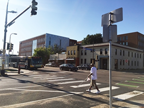
The crash risk for pedestrians and bicyclists is higher in Minneapolis neighborhoods that have lower household incomes and higher populations of minorities.
For their analysis, U of M researchers determined crash numbers and frequencies for pedestrian and bicycle crashes in Minneapolis between 2005 and 2017. They then developed new models of pedestrian and bicycle crash risk and used them to predict crashes at all of the city’s intersections and mid-blocks. Next, they used statistical tests to assess how equitably the estimated crash risk is distributed in the city.
They found that people in Minneapolis who live in lower-income neighborhoods in which more than half the population is minority face higher crash risk than those individuals who live in more affluent, majority-white neighborhoods, especially at intersections.
The team then developed new indices of crash risk and showed how they could complement or augment rankings currently used by the city to prioritize street improvement projects.
Principal investigator: Greg Lindsey, Humphrey School of Public Affairs. Co-investigator: Jason Cao, Humphrey School. Sponsor: Roadway Safety Institute.
Learn more: “Crash risk for pedestrians, cyclists higher in less affluent neighborhoods,” CTS Catalyst, January 2020
Transitway investment leads to higher regional GDP, job growth, and accessibility
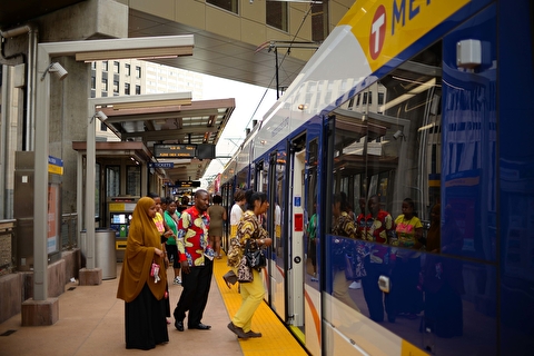
Transitway investment adds considerable economic value to metropolitan regions, including the Twin Cities area, and increases access to the places people need to reach to prepare for, get, and keep a good job. Transitways also provide more equitable access for people of color and residents of areas with concentrated poverty.
Transitway investment does not, however, measurably change a region’s median household income or income inequality. While a whole region may see growth from transitway investment, researchers found no direct impact on how income is distributed. Without proper planning, investment in low-income minority neighborhoods—often at risk for gentrification—may not benefit disadvantaged population groups.
Principal investigator: Yingling Fan, Humphrey School of Public Affairs. Co-investigator: Andrew Guthrie, University of Memphis. Sponsor: Transitway Impacts Research Program.
Learn more: “Transitway investment leads to higher regional GDP, job growth, and accessibility,” CTS Catalyst, July 2020
Tool helps local agencies prepare for connected and automated vehicles
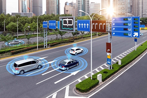
Experts predict the implementation of connected and automated vehicles (CAVs) will soon be widespread. To help prepare for this change, researchers developed a reference tool that local transportation agencies can use to anticipate the infrastructure needs for CAVs and plan for infrastructure upgrades and maintenance activities.
Transportation planners often anticipate decades of service from infrastructure such as traffic signal control technology and signage, so the decisions they make today must reflect the needs of CAV technologies. Researchers created a matrix of infrastructure applications—with cost projections—to accompany the detailed descriptions in their report.
Principal investigator: John Hourdos, Minnesota Traffic Observatory. Sponsor: Minnesota Local Road Research Board.
Learn more: “How can local agencies prepare for connected and automated vehicles?,” CTS Catalyst, January 2020
Monitoring system provides decade of data from I-35W bridge
On August 1, 2007, the I-35W Saint Anthony Falls Bridge collapsed in Minneapolis. Its replacement was instrumented with more than 500 sensors to record the new structure’s behavior and evaluate the effectiveness of different monitoring strategies. A 10-year review of the bridge’s monitoring system is available from U of M researchers.
The continuous operation of the I-35W bridge monitoring system makes it one of the longest-lived in the country. The report provides insight regarding the relative strengths of the instrumentation systems and potential considerations for future system deployments. One key finding is that seasonal and daily temperature variations have a big impact on the bridge’s behavior—so the instrumentation needed to measure temperature and its impacts is the most important technology for long-term monitoring.
Principal investigator: Lauren Linderman, Civil, Environmental, and Geo- Engineering (CEGE). Co-investigators: Carol Shield (CEGE) and Brock Hedegaard (U of M Duluth). Sponsor: MnDOT.
Learn more: “Monitoring system provides decade of data from I-35W bridge,” CTS Catalyst, August 2020
Researchers develop alert system to protect cyclists from cars
Photo: Olivia Hultgren
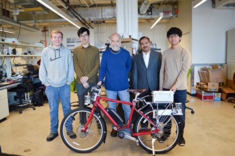
A research team is developing a smart bicycle with an attached alert system that sounds a horn when cars get too close to the cyclist. The team is collaborating with cycling manufacturer Quality Bicycle Products to test the technology.
The system uses sensor technology created for automated vehicles. It comprises three sensors that monitor the trajectories of nearby vehicles, speakers, and a black-box camera that records video when the cyclist is in danger. A key goal is to minimize the cost of the system.
Researchers worked with local cyclists in 2019 to test the alert system. Although further testing was postponed because of the pandemic, the team aims to have a marketable product in coming years.
Principal investigator: Rajesh Rajamani, Mechanical Engineering (ME). Co-investigator: Max Donath (ME). Sponsor: National Science Foundation; prototype funded by the Roadway Safety Institute.
Local cyclists who tested the alert system said it gave them “peace of mind” to know that potential bad behaviors by drivers near them would be recorded on video.
Learn more: “Researchers develop alert system to protect cyclists from cars,” CTS Catalyst, February 2020
Researchers rate job accessibility for five Twin Cities transitway scenarios
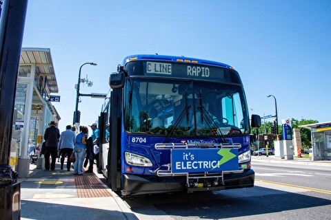
Transitway service is expanding across the Minneapolis–Saint Paul metro area. In an analysis for the Metropolitan Council, Accessibility Observatory researchers evaluated job accessibility for five transitway scenarios.
The team first compared the network as of May 2019 to the funded baseline. The funded baseline adds the C Line along Penn Avenue, the Orange Line along I-35W to Lakeville, and the Green Line extension to Eden Prairie.
They then compared the funded baseline accessibility results to those of three proposed lines: The B Line along Lake Street, the D Line along Emerson/Fremont and Chicago Avenues, and the E Line along Hennepin and France Avenues. The transitways were evaluated in isolation and in a scenario combining all three.
The results show that all five scenarios improve accessibility across the region and especially increase accessibility for workers living near transit stops.
Principal investigator: Andrew Owen, Accessibility Observatory. Sponsor: Metropolitan Council as part of the National Accessibility Evaluation, a multi-year effort led by MnDOT.
Learn more: “Researchers rate job accessibility for five Twin Cities transitway scenarios,” CTS Catalyst, April 2020
