After testing a newly designed smartphone app at six Minnesota intersections, U of M researchers say it can successfully guide pedestrians who are blind or visually impaired through signalized and unsignalized intersections.
“Our system allows transportation agencies to provide more accessible traffic information for people who are visually impaired,” says Chen-Fu Liao, a senior research associate with the Department of Mechanical Engineering. “This information improves their mobility and independence in using the transportation system.”
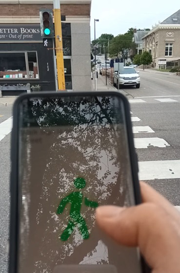
This latest study builds on previous research in which researchers developed an app that directs pedestrians with visual impairment through work-zone sidewalks. Knowing they could do much more in this field with smartphone features, they created an app that accesses traffic signal data. Using that app along with several smartphone capabilities, they then created another app—PedNav—to assist pedestrians with visual impairments through intersection crosswalks.
In this project, researchers examined the efficacy of PedNav in a controlled, real-world setting. This work and earlier efforts were all funded by the Minnesota Department of Transportation (MnDOT).

PedNav was tested in Stillwater, Minnesota, at six intersections—four signalized and two unsignalized. The project had three key goals: installing a system that could access traffic controller data and broadcast it through a wireless network, refining the smartphone-based system that accesses and displays traffic information, and validating the system’s performance by testing it at signalized and unsignalized intersections.
The testing setup involved several technical operations. Researchers created a digital map to store the test area’s intersection and signal information and deployed a network of Bluetooth low-energy beacons. With assistance from MnDOT, researchers installed hardware within each of the four intersection signal controller cabinets that would broadcast real-time signal phasing and timing information. The research team also deployed a data collection system and evaluated the wireless traffic network’s security. Once the setup was complete, researchers repeatedly tested the app at the intersections for position and message accuracy.
The system functioned effectively in the real-world tests, Liao says, delivering correct messages on intersection geometry and signal status information 96 percent of the time. The few incorrect messages were caused by improper measurements by the phone’s digital compass, which can be distorted if the user is near a large metal object.
“This was a good project, with the innovative use of technology that we hope will benefit individuals with visual impairment,” says Michael Fairbanks, signal operations engineer with MnDOT’s Metro District.
To spur the future use of PedNav, researchers outlined the next steps for implementation. These include creating guidelines for wireless traffic data in a connected community and identifying intersections where there is a knowledge gap for pedestrians who are blind or visually impaired.
Writer: Megan Tsai


